Level up your sustainability IQ for a Greenr future
Empower your workforce to make sustainability a reality. Inspire your employees to take meaningful steps towards achieving your company’s environmental goals.

Greenr at Work
Harness collective power to tackle environmental challenges
Greenr is a Sustainability as a Service Platform that offers an employee engagement app to educate and empower the world’s largest workforce - “Employees”. We aim to engage employees to share responsibility &contribute towards companies’ net zero targets.
Our Approach


Educate
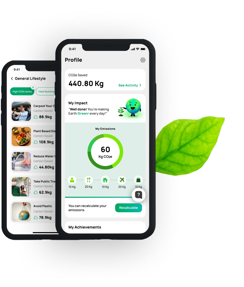
Climate Aware Teams
Equip your employees with the knowledge to improve their Greenr IQ. Through personalized content, quizzes, and actionable insights, foster a deeper understanding of sustainability concepts that drive smarter choices every day.
Greenr's Impact
Measuring Our Eco Achievements
10298
T of CO2e avoided for the planet
452000
Equivalent trees growing for 1 year
4520
Cars off the road
72
Countries reached
Our Partners

Success Stories
See how Greenr has helped organizations drive global sustainability. Discover testimonials showcasing positive environmental impacts.

At Tandem, we're committed to helping more & more people choose a greener lifestyle, and it starts with our team! We're thrilled to be able to provide both our customers and our staff with tools like this, that support our mission of banking for a greener future. Tandem provides every employee with a way to track their own carbon footprint and discover the best methods to reduce it.

Greenr has made sustainability fun for our team. The trivia, insights, and competitions have sparked conversations and fostered a sense of collective responsibility. Our team is now more mindful of their daily choices and actively working together towards a greener future.

At Liberate Wealth, we’re committed to reducing our carbon footprint, and Greenr’s solutions have been a game-changer. Their tools empower our employees with the resources and insights needed to make impactful changes, aligning with our sustainability goals. We’ve been truly impressed with how Greenr supports our mission for a greener future.

Greenr’s Employee Engagement App has elevated our sustainability efforts. By measuring our carbon footprints, the app provided insights that shaped our emissions report. It also offered practical tips, making it easy for our team to contribute to our goals. Greenr has fostered a collective sense of responsibility and heightened our environmental awareness.
Greenr has made sustainability fun for our team. The trivia, insights, and competitions have sparked conversations and fostered a sense of collective responsibility. Our team is now more mindful of their daily choices and actively working together towards a greener future.
At Liberate Wealth, we’re committed to reducing our carbon footprint, and Greenr’s solutions have been a game-changer. Their tools empower our employees with the resources and insights needed to make impactful changes, aligning with our sustainability goals. We’ve been truly impressed with how Greenr supports our mission for a greener future.
Success Stories
See how Greenr has helped organizations drive global sustainability. Discover testimonials showcasing positive environmental impacts.
At Tandem, we're committed to helping more & more people choose a greener lifestyle, and it starts with our team! We're thrilled to be able to provide both our customers and our staff with tools like this, that support our mission of banking for a greener future. Tandem provides every employee with a way to track their own carbon footprint and discover the best methods to reduce it.
Frequently Asked Questions
Greenr assists organizations by integrating sustainable practices into their operations, offering cutting-edge technology solutions, and fostering a culture of sustainability. Our holistic approach ensures lasting impact and measurable results.
Greenr offers sustainable solutions such as education on corporate policies, gamification for employee engagement, collaboration platforms for project execution, tools for goal tracking and measurement, and recognition programs for celebrating achievements—all aimed at fostering a culture of sustainability within organizations.
Greenr helps organizations achieve sustainability by educating employees on corporate policies and best practices, motivating them through gamification and rewards, facilitating collaboration on sustainability projects, providing tools for tracking and measuring goals, and fostering a culture of recognition for sustainable achievements. This holistic approach empowers organizations to implement and sustain impactful environmental initiatives across their operations.
Greenr helps organizations meet industry sustainability standards by providing tools for setting and tracking goals, fostering collaboration among teams, and offering expert guidance on implementing sustainable practices. This enables businesses to align with industry best practices and achieve measurable environmental impact.
Let’s Get in Touch
Fill out the form to discover what Greenr can do for you! Our team will reach out to schedule your demo.
OR
Reach out to us -support@greenr.com